GPS System
Nepal Gps operating system
Current Features:
Example Screen Shots:
See OpenGTS in action at http://track.opengts.org/track/Track
Licensing:
Additional Features:

 Garmin Tech Center (台灣國際航電科技大樓) is the head office of Garmin (Asia) Corporation
Gary Burrell, born in 1937, earned a degree in Electrical Engineering from Wichita State University and a graduate degree from the Rensselaer Polytechnic Institute. He went to work for King Radio, a manufacturer of aviation radios in 1963 just six years after that company was started by Edward King, Jr. in a farmhouse in Olathe. A certificated pilot, Burrell led development on some of King’s most successful navigation and communications products. The King Radio company went on to supply Boeing with aircraft radio equipment starting in 1969.
By 1989, Burrell had spent nearly his entire professional career — with the exception of a brief stint at Lowrance Electronics — working for King Radio. During these years the company went through many corporate changes. In 1983 King was acquired by the Allied Corporation and combined with the former Bendix Corporation to form Bendix-King. Allied later went on to merge with the Signal Companies in 1985 to form AlliedSignal[3] which acquired Honeywell in 1999 and then assumed the Honeywell name.

Corporate headquarters in Olathe, KSMin H. Kao (Name in Chinese: 高民環), was born in 1949 in the small town of Jhushan in Nantou in Taiwan (南投縣). After serving in the Taiwanese Navy Kao attended National Taiwan University and moved to the United States to attend the University of Tennessee where he obtained advanced degrees in Electrical Engineering. As a graduate student he performed research for the National Aeronautics and Space Administration and the United States Army. He later went on to work for American defense contractors Teledyne and Magnavox.
Burrell hired Kao to join his division at Allied’s King subsidiary in 1983. Kao had been working at Magnavox developing military navigation systems using the Global Positioning System constellation of satellites, at that time known as NAVSTAR. During his years working with Burrell, Kao led the team that developed the first GPS navigation system that was to be certified for use in airplanes by the U.S. Federal Aviation Administration.
At the time the satellite constellation was still being assembled. The 1986 explosion of the Space Shuttle Challenger had set the system’s construction back by 24 months. The satellites had to be redesigned to fit aboard a Delta II rocket. The system was declared operational in April 1989, and went on to prove a decisive strategic advantage to U.S. and Allied forces in the 1991 Gulf War.[4]
Kao had been thinking of starting a company, and had recently visited old school friends in Taiwan, one of whom was an investment banker, who assured Kao that if he wanted to launch a company, launch money would be available. Within weeks of their meeting, Burrell and Kao were on a plane to Taipei, Taiwan. Within months, they had raised $4 million, including the combined contents of their personal savings accounts. The capital was sufficient to hire a dozen engineers and to rent office and work space in Lenexa, Kansas. They named the new company ProNav, but changed it to Garmin in 1991 when a competitor, using the name NavPro on one of its GPS receivers, sued for trademark infringement. “Garmin” is a combination of the founders’ names, Gary and Min.
By 1999 the company’s products had captured about half of the North American market share of GPS receivers used in marine and outdoor recreation markets, according to a market study conducted by Frost and Sullivan. Its own internal estimates showed that its aviation retrofit products had 59% market share, and that its portable aviation GPS products had 76% of the market.[citation needed]
Burrell retired in 2003 as Garmin’s Chief Executive Officer and in 2004 retired as Chairman of its Board of Directors. He is now Chairman Emeritus. Kao became CEO in 2003, and Chairman in 2004.[6]
In 2005 Forbes Magazine estimated Kao’s net worth at $1.5 billion. He has donated $17.5 million to the University of Tennessee. The same year Forbes estimated Burrell’s net worth as $940 million.[7]
The company began public trading on NASDAQ on 8 December 2000. At that time Burrell owned 19,911,155 shares. Kao owned 20,352,803 shares. Together their holdings accounted for 45 percent of the stock in Garmin. Kao’s brother, Ruey-Jeng Kao, an attorney in Taipei, owned another 7,984,109 shares, which when combined with Burrell’s and Kao’s shares constituted 54.22 percent of the shares outstanding.[9]
Garmin has acquired Dynastream Innovations,[11] EME Tec Sat SAS (EME),[12] and Digital Cyclone.[13] Dynastream, located in Cochrane, Alberta, Canada, is a leader in the field of personal monitoring technology (ANT+) — such as foot pods and heart rate monitors for sports and fitness products — and is also a leading provider of ultra-low-power and low-cost wireless connectivity solutions for a wide range of applications (ANT). EME Tec Sat SAS (EME) is the distributor of Garmin's consumer products in France; following the acquisition, EME will change its name to Garmin France SAS. Digital Cyclone Inc (DCI), located in Chanhassen, Minnesota, provides mobile weather solutions for consumers, pilots, and outdoor enthusiasts. Garmin also bought Nautamatic Marine Systems,[14] an Oregon-based company that makes autopilot systems for boats.

A late-model Garmin eTrex H showing a solid fix from multiple satellites.One of the most popular of the Garmin handheld GPS receivers, the compact eTrex series, was introduced in 1998. Within the eTrex line are several models packaging several different features and options. The original eTrex, commonly nicknamed "eTrex Yellow", was a sensation when it first appeared, as it offered a lightweight (5.3 oz/150 g), waterproof, palm-sized 12-channel GPS receiver to backpackers, hikers, and others afoot in remote areas, along with a battery life of up to 22 hours on just two AA-size batteries.[18] The eTrex 'Yellow' was replaced in 2007 by the eTrex H, which added a high-sensitivity receiver.[19] Other more advanced eTrex models include the Summit, Venture, Legend, and Vista, each with various additional features such as WAAS, altimeter, digital compass, city database, and highway maps. Many models come in color and expandable-memory versions.[20]
The Geko series is a later compact line of handheld GPS receivers aimed at the budget or lightweight hiking market.
In 2004 Garmin introduced its 60C line of handheld GPS mapping receivers, featuring increased sensitivity and storage capacity along with a battery life of up to 30 hours in battery-save mode. This was followed by the 60Cx and 60CSx with improved color map displays. The 60Cx and 60CSx have been used as primary navigational tools on several adventure and exploration trips to remote areas around the world, including a rafting expedition down the entirety of the Amazon River in 2008.[21][22][23]
With the GTM-11, GTM 20 and GTM 25, a Garmin GPS device receives and uses Traffic Message Channel (TMC) information.[24] Also, some Garmin nüvi (1690, 1490T, 1450T, 1390T, 1390, 1350, 1260, 1250 and 265WT, 265T, 265W, 265, 255w and 255) comes with an integrated TMC receiver.
In October 2006, Garmin began shipping the nüvi 660, a pocketsize widescreen successor to their nüvi 300 series. The 660 added bluetooth, FM transmitter, enhanced screen brightness and screen size, all in a small "flat" size.
Additionally, Garmin's Zumo line is designed specifically for motorcycles. The Zumo 550 and StreetPilot 2610 with slightly different feature sets have been marketed as an OEM offering by BMW for their motorcycles as the BMW Zumo and BMW Navigator III.
Lately Garmin has released its 1000's series which includes the 1690 which incorporates the ability to use Google Local Search to have more up to date Points of Interest and has the ability tap into the 3G network. Garmin has furthered its technology in this field to make one of the thinnest models in the 3700 series as well.
Garmin released 2000's series in 2010, which includes 2200(3.5 inches display), and 2300(4.3 inches display).

Garmin avionicsGarmin has a dedicated division for aviation products, such as integrated cockpits, panel mount displays, multi-function displays (MFD), transponders, radar and other related avionics. For example, the G1000 is an all-glass avionics suite for OEM aircraft.[28] The G900X is similar to the G1000 but designed for use in experimental aircraft,[29] and the G600 is a retrofit solution for several certificated aircraft.[30]
Garmin entered the aviation market in 1991 with the GPS-100AVD panel-mounted receiver. Their first portable unit, the GPS-95, was introduced in 1993. In 1994, the GPS-155 panel-mounted unit was the first GPS receiver on the market to receive full FAA certification for instrument approaches.[31][32]
In 1998 Garmin introduced the GNS-430, an integrated GPS navigation receiver/communications transceiver.[31]
In April 2007 the Oregon-based aircraft company Epic AIR (subsidiary of Aircraft Investor Resources (AIR) LLC — United States) announced that it would use Garmin glass panel cockpits and related avionics in all of its certified and experimental very light jets and turboprop aircraft. The Garmin G900X will be used in the company's owner-built airplanes, while the Garmin G1000 will be used in certified Epic aircraft.[33]
IImorrow soon phased out of the marine business and focused on development of technology for taking UPS from paper into the computer era, vehicle management systems, automated high speed package sorting systems, as well as delivery and tracking systems. In 1999 With this done, IImorrow was re-named to UPS Aviation Technologies, and they were re-focused towards modernizing UPS's Boeing 7xx series Heavy Iron Transport Category Aircraft fleet, as well they also re-entered the General Aviation marketplace. This company (UPS Aviation Technologies) certified the first Gamma 3 WAAS GPS engine for FAA Certified Precision GPS approaches (basically, precision landing of aircraft by GPS). The new certified WAAS engine enabled vertical and horizontal accuracy of 1 meter RMS, for precise guidance into airports without existing ILS approaches. Their new GPS technology even met the FAA's stringent TSO-C146a primary navigation standards for en route, terminal and approach phases of flight- with WAAS augmentation as "sole means" navigation. Further it enabling vertical and lateral approach guidance into thousands of U.S. airports previously inaccessible in IFR conditions. This unique first of kind, GPS "sole source" (not supplementary) navigation capability was integrated into the CNX-80. The CNX-80 WAAS GPS/COM/NAV integrated navigator was the first product in the industry approved for primary (not supplemental) GPS navigation. It also enabled LPV "glidescope" approaches without reference to ground-based nav aids of any kind, as well as new LNAV (GPS) approaches providing the accuracy and safety of an ILS – without the ground-based localizer and glideslope equipment. Later, the CNX-80 was re-named the GNS-480, under Garmin.
As UPS Aviation Technologies, this subsidiary was also fundamentally involved with development, engineering, and manufacturing functional products for the FAA's Capstone program, which also included ADS-B transponder (UAT and FIS), datalink services, and the MX-20 Multi Function Display that in addition to NAV, it displayed terrain, real-time weather, Jeppeson plates, other ADS-B aircraft, and a variety of other functions in 2000.
Under the FAA Capstone Phase I program, a fleet of small commercial aircraft were equipped for an evaluation of the safety benefits stemming from the use of advanced technologies during day-to-day operations in Alaska's high-risk operating environment. The aircraft are fitted with IFR capable global positioning system (GPS) receivers, a Universal Access Transceiver (UAT) data-link system that enables Automatic Dependent Surveillance-Broadcast (ADS-B) and Flight Information Services (FIS) including real-time weather, and a multifunction display (MFD) depicting terrain, other ADS-B aircraft, and weather graphics and text data. The bundle of avionics was installed on some 200 aircraft used for commuter, charter and mail flights in southwest Alaska. The avionics improved the pilot's situational awareness with the primary goal of preventing controlled flight into terrain (CFIT) and mid-air accidents.
Due to the reduction in accidents as well as credited saving the life of a downed pilot whose ELT had failed, the new system developed traction through several phases, and in December 2006, the FAA announced that it would integrate Capstone into the FAA’s Surveillance and Broadcast Services (SBS) program office tasked with implementing ADS-B across the national airspace system.
This advanced GPS technology was later rolled into the 430/530 by Garmin-AT (Salem), creating the 430W/530W. To this day, the "IImorrow" division is still located at the same 2345 Turner Rd. SE, Salem, Oregon address as Garmin-AT. [34]
The maps used by Garmin products are currently provided by Navteq.[36] Map errors are handled using NAVTEQ Map Reporter.[37] Errors can be reported using Garmin's report a map error page,[38] or by using the NAVTEQ map reporter.[39]
 The US system will be used as a test bed for internet security projects
The system will allow researchers to simulate attacks by foreign powers and from hackers based inside the US.
More than $500m (£309m) has been allocated by the Department of Defense to develop "cyber technologies".
The National Cyber Range project is being overseen by the Defense Advance Research Projects Agency (Darpa), which was also involved in early network research that led to the internet.
When ready, it will function as a test-bed for defensive and possibly offensive technologies such as network protection systems.
Having a controllable mini-internet would allow researchers to carry-out experiments "in days rather than the weeks it currently takes," Darpa spokesman Eric Mazzacone told the Reuters news agency.
Unlike the real internet, the in-house version could be wiped or reset between tests, explained Mr Mazzacone.
Development of the National Cyber Range is currently in the hands of several organisations, including Johns Hopkins University in Baltimore and Lockheed Martin.
One of their prototypes will be selected to go into operation later in the year.
Act of war The United States has been gradually increasing funding for internet security-related projects.
 US defence secretary Robert Gates said that the country was under almost constant cyber attacks In 2008, the US military was the subject of a serious cyber attack when part of its network became infected by a worm known as agent.btz.
President Obama, in May 2009, declared the cyber threat to be one of the "most serious" challenges facing the country.
Since then, his government claims to have been the subject of several attempted attacks, originating from overseas.
Lockheed Martin, one of the contractors involved in the National Cyber Range project was itself the subject of a security breach in May 2011.
Earlier this month, the Pentagon said it planned to publish proposals to categorise cyber attacks as acts of war.
History & Vision  Unlike pure research companies or universities, Cybernet has been committed since its inception to successfully developing technology and bringing its research to market. By specifically focusing on technologies that enhance human performance, Cybernet has successfully converted research and development endeavors into commercially viable and useful products for the commercial, defense and medical markets. Cybernet Chairman and CEO, Heidi Jacobus founded the company while pursuing her doctorate in computer science from the University of Illinois, Urbana. With Chuck Jacobus, her husband, Heidi launched the company with the ultimate objective of blurring the lines of human interaction with devices to the point where such interaction becomes transparent. In the company’s two decades, Cybernet has made significant contributions to the health, productivity and security of America and the world. Together with a dedicated staff made of engineers, scientists and skilled business professionals, Heidi and Chuck have built Cybernet Systems Corporation into a trusted partner for the U.S. government and private contractors alike, providing solutions to some of the world’s biggest challenges. CybernetFrom Wikipedia, the free encyclopedia This article is about the television show. For the fraudulent company CyberNet Engineering, see Barton H. Watson.
The programme featured reviews, previews, tips and reports on video gaming and computer technology. [edit] Voice-oversDuring its thirteen-year run, Cybernet was presented out-of-vision by a number of voiceover artists:
[edit] References
[edit] External links
OpenGTS™ - Open GPS Tracking System | |||||||||||||||||||||||||

OpenGTS™ ("Open GPS Tracking System") is the first available open source project designed specifically to provide web-based GPS tracking services for a "fleet" of vehicles.
To date, OpenGTS™ has been downloaded and put to use in over 90+ countries around the world to track many 1000's of vehicles/assets around all 7 Continents. The types of vehicles and assets tracked include taxis, delivery vans, trucks/trailers, farm equipment, personal vehicles, service vehicles, containers, ships, ATVs, personal tracking, cell phones, and more.
While OpenGTS™ was designed to fill the needs of an entry-level fleet tracking system, it is also very highly configurable and scalable to larger enterprises as well.
Current Features:
OpenGTS not only supports the data collection and storage of GPS Tracking and Telemetry data from remote devices, but also includes the following rich set of features:
- Web-based authentication: Each account can support multiple users, and each user has its own login password and controlled access to sections within their account.
- GPS tracking device independent: Devices from different manufacturers can be tracked simultaneously. Support for the following GPS tracking devices is included with OpenGTS:
- Aspicore GSM Tracker (Nokia, Samsung, Sony Ericsson phones)
- Sanav GC-101, MT-101, and CT-24 Personal Tracker (HTTP-based protocol)
Sanav GX-101 Vehicle Tracker (HTTP-based protocol)
- V-Sun 3338 Personal Tracker
- Certain Boost Mobile phones (OpenDMTP compliant)
- Android App "GPS2OpenGTS"
- HP hw6965 Windows/CE phone (OpenDMTP compliant)
- TAIP (Trimble ASCII Interface Protocol).
- ZhongShan Technology Co, Ltd. "SIPGEAR" tracking devices.
- Most TK102 tracking devices.
- TrackStick GPS data logger
- "GPSMapper" capable phones.
- "NetGPS" capable devices.
- iCare G3300 Personal Tracker.
- Some Mologogo capable phones.
- Aspicore GSM Tracker (Nokia, Samsung, Sony Ericsson phones)
- Customizable web-page decorations: The look and feel of the tracking web site can easily be customized to fit the motif of the specific company.
- Customizable mapping service: OpenGTS comes with support for OpenLayers/OpenStreetMap in addition to support for Google Maps, Microsoft Virtual Earth, and Mapstraction (which provides mapping support for MultiMap, Map24, MapQuest, and more). Within the OpenGTS framework, other mapping service providers can also easily be integrated.
- Customizable reports: Using an internal XML-based reporting engine, detail and summary reports can be customized to show historical data for a specific vehicle, or for the fleet.
- Customizable geofenced areas: Custom geofenced areas (geozones) can be set up to provide arrival/departure notification (additional coding may be required). Each geozone can also be named to provide a custom 'address' which is displayed on reports when inside the geozone (for instance "Main Office").
- Operating system independent: OpenGTS itself is written entirely in Java, using technologies such as Apache Tomcat for web service deployment, and MySQL for the datastore. As such, OpenGTS will run on any system which supports these technologies (including Linux, Mac OS X, FreeBSD, OpenBSD, Solaris, Windows XP, Windows Vista, Windows 20XX, and more).
- i18n Compliant: OpenGTS is i18n compliant and supports easy localization (L10N) to languages other than English. Languages supported currently include Dutch, English, French, German, Greek, Hungarian, Italian, Portuguese, Romanian, Russian, Slovak, Spanish, Serbian, and Turkish.
Example Screen Shots:
| Main Menu: | GPS Tracking Map: |
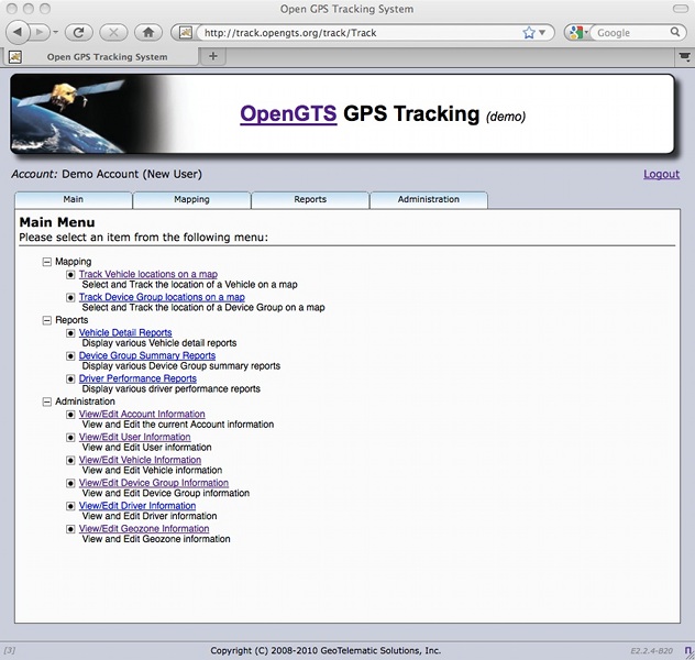 | 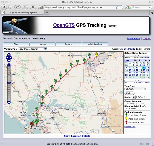 |
See OpenGTS in action at http://track.opengts.org/track/Track
Licensing:
OpenGTS is licensed under the Apache Software License, version 2. According to the terms of this license, anyone may freely download and distribute the tools and information released here.
Additional Features:
The "GTS Enterprise" is the commercial GPS tracking/telematic system built upon the capabilities of OpenGTS™. Click here to find out more about the "GTS Enterprise".
Garmin Ltd. (NASDAQ: GRMN), incorporated in Schaffhausen, Switzerland, is the parent company of a group of companies founded in 1989 by Gary Burrell and Min Kao (hence the name GarMin), that develops consumer, aviation, and marine technologies for the Global Positioning System. Its subsidiary Garmin International, Inc. serves as headquarters for the Garmin Limited companies and is located in Olathe, Kansas, which is located in the Kansas City Metropolitan Area in the United States. The largest operating subsidiary and primary production facility of Garmin Limited is Garmin (Asia) Corporation (Chinese: 台灣國際航電股份有限公司), located in Sijhih City, Taiwan, a suburb of Taipei.
Contents[hide] |
[edit] History
[edit] Founding
| This article needs additional citations for verification. Please help improve this article by adding reliable references. Unsourced material may be challenged and removed. (October 2009) |
By 1989, Burrell had spent nearly his entire professional career — with the exception of a brief stint at Lowrance Electronics — working for King Radio. During these years the company went through many corporate changes. In 1983 King was acquired by the Allied Corporation and combined with the former Bendix Corporation to form Bendix-King. Allied later went on to merge with the Signal Companies in 1985 to form AlliedSignal[3] which acquired Honeywell in 1999 and then assumed the Honeywell name.

Burrell hired Kao to join his division at Allied’s King subsidiary in 1983. Kao had been working at Magnavox developing military navigation systems using the Global Positioning System constellation of satellites, at that time known as NAVSTAR. During his years working with Burrell, Kao led the team that developed the first GPS navigation system that was to be certified for use in airplanes by the U.S. Federal Aviation Administration.
At the time the satellite constellation was still being assembled. The 1986 explosion of the Space Shuttle Challenger had set the system’s construction back by 24 months. The satellites had to be redesigned to fit aboard a Delta II rocket. The system was declared operational in April 1989, and went on to prove a decisive strategic advantage to U.S. and Allied forces in the 1991 Gulf War.[4]
Kao had been thinking of starting a company, and had recently visited old school friends in Taiwan, one of whom was an investment banker, who assured Kao that if he wanted to launch a company, launch money would be available. Within weeks of their meeting, Burrell and Kao were on a plane to Taipei, Taiwan. Within months, they had raised $4 million, including the combined contents of their personal savings accounts. The capital was sufficient to hire a dozen engineers and to rent office and work space in Lenexa, Kansas. They named the new company ProNav, but changed it to Garmin in 1991 when a competitor, using the name NavPro on one of its GPS receivers, sued for trademark infringement. “Garmin” is a combination of the founders’ names, Gary and Min.
[edit] Company growth
By 1995 Garmin’s sales had reached $105 million, and had achieved a profit of $23 million. By 1999 sales had reached $233 million and profit of $64 million. Garmin reported a 2006 total revenue of $1.77 billion, up 73 percent from $1.03 billion in 2005.[5]

By 1999 the company’s products had captured about half of the North American market share of GPS receivers used in marine and outdoor recreation markets, according to a market study conducted by Frost and Sullivan. Its own internal estimates showed that its aviation retrofit products had 59% market share, and that its portable aviation GPS products had 76% of the market.[citation needed]
Burrell retired in 2003 as Garmin’s Chief Executive Officer and in 2004 retired as Chairman of its Board of Directors. He is now Chairman Emeritus. Kao became CEO in 2003, and Chairman in 2004.[6]
In 2005 Forbes Magazine estimated Kao’s net worth at $1.5 billion. He has donated $17.5 million to the University of Tennessee. The same year Forbes estimated Burrell’s net worth as $940 million.[7]
[edit] Public offering
By 2000 Garmin had sold three million GPS devices, and was producing 50 different models. Its products were sold in 100 countries and carried by 2,500 independent distributors. As of 22 August 2000, the company held 35 patents on GPS technology. By the end of June 2000, the company employed 1,205 people: 541 in the United States, 635 in Taiwan, and 29 in the United Kingdom.[8]The company began public trading on NASDAQ on 8 December 2000. At that time Burrell owned 19,911,155 shares. Kao owned 20,352,803 shares. Together their holdings accounted for 45 percent of the stock in Garmin. Kao’s brother, Ruey-Jeng Kao, an attorney in Taipei, owned another 7,984,109 shares, which when combined with Burrell’s and Kao’s shares constituted 54.22 percent of the shares outstanding.[9]
[edit] Worldwide companies
Garmin operates in several other countries besides the UK, USA and Taiwan. It operates as Formar (Belgium), Garmin AMB (Canada), Belanor (Norway), and Trepat (Spain).[edit] Acquisitions
In August 2003 Garmin completed acquisition of UPS Aviation Technologies, Inc., a subsidiary of United Parcel Service, Inc., expanding its product line of panel-mounted GPS/NAV/COMM units and integrated cockpit systems for private and commercial aircraft. The acquired company changed its name to Garmin AT, Inc. and continued operations as a wholly owned subsidiary of Garmin International, Inc.[10]Garmin has acquired Dynastream Innovations,[11] EME Tec Sat SAS (EME),[12] and Digital Cyclone.[13] Dynastream, located in Cochrane, Alberta, Canada, is a leader in the field of personal monitoring technology (ANT+) — such as foot pods and heart rate monitors for sports and fitness products — and is also a leading provider of ultra-low-power and low-cost wireless connectivity solutions for a wide range of applications (ANT). EME Tec Sat SAS (EME) is the distributor of Garmin's consumer products in France; following the acquisition, EME will change its name to Garmin France SAS. Digital Cyclone Inc (DCI), located in Chanhassen, Minnesota, provides mobile weather solutions for consumers, pilots, and outdoor enthusiasts. Garmin also bought Nautamatic Marine Systems,[14] an Oregon-based company that makes autopilot systems for boats.
[edit] Recent corporate activity
In 2006, Garmin released all of its software for Mac OS X.[15] Also in 2006, Garmin introduced a new corporate logo,[16] and the opening of its first retail store on Michigan Avenue in Chicago, Illinois.[17][edit] Products and brands
See also: List of Garmin products
[edit] Marine GPS
The company’s first product was the GPS 100, a panel-mounted GPS receiver aimed at the marine market, priced at $2,500. It debuted at the 1990 International Marine Technology Exposition in Chicago. The product was an instant hit and generated a backlog of orders for 5,000 units. In response to the demand thus created, Kao traveled (January 1991) to Taipei to set up manufacturing facilities.[edit] Handheld GPS
Another early product, a handheld GPS receiver, proved popular with military personnel serving in Kuwait and Saudi Arabia during the 1991 Gulf War. In the early 2000s, Garmin launched a series of personal GPS devices aimed at recreational runners called the Forerunner. A similar wrist-worn GPS device with two dimensional GPS tracking and waypoint projection called the Garmin Foretrex is popular among day hikers, off-road mountain bikers, and sailboat racers.
The Geko series is a later compact line of handheld GPS receivers aimed at the budget or lightweight hiking market.
In 2004 Garmin introduced its 60C line of handheld GPS mapping receivers, featuring increased sensitivity and storage capacity along with a battery life of up to 30 hours in battery-save mode. This was followed by the 60Cx and 60CSx with improved color map displays. The 60Cx and 60CSx have been used as primary navigational tools on several adventure and exploration trips to remote areas around the world, including a rafting expedition down the entirety of the Amazon River in 2008.[21][22][23]
With the GTM-11, GTM 20 and GTM 25, a Garmin GPS device receives and uses Traffic Message Channel (TMC) information.[24] Also, some Garmin nüvi (1690, 1490T, 1450T, 1390T, 1390, 1350, 1260, 1250 and 265WT, 265T, 265W, 265, 255w and 255) comes with an integrated TMC receiver.
[edit] iQue PDA receivers
Main article: Garmin iQue
In 2003 Garmin launched the iQue line of integrated PDA-GPS receivers. On 31 October 2005 the iQue M4 became the first PDA that did not require a PC to preload the maps. The American version came with built-in maps of North America, while the UK version was supplied pre-loaded with maps of Western Europe.[edit] On The Road GPS
In October 2005, Garmin released the StreetPilot i-Series, compact GPS navigators which come in three models, i2, i3, i5. The i2 has a monochrome display, and maps need to be loaded on a Transflash card. The i3 is similar to the i2, except it has a color screen. The i5 has a color screen and the maps come preprogrammed into the device. More advanced versions of the StreetPilot include the c-Series, some of which sport large colour touchscreens, FM traffic notifications, support for weather and information updates from MSN Direct, and Bluetooth support.

In October 2006, Garmin began shipping the nüvi 660, a pocketsize widescreen successor to their nüvi 300 series. The 660 added bluetooth, FM transmitter, enhanced screen brightness and screen size, all in a small "flat" size.
Additionally, Garmin's Zumo line is designed specifically for motorcycles. The Zumo 550 and StreetPilot 2610 with slightly different feature sets have been marketed as an OEM offering by BMW for their motorcycles as the BMW Zumo and BMW Navigator III.
Lately Garmin has released its 1000's series which includes the 1690 which incorporates the ability to use Google Local Search to have more up to date Points of Interest and has the ability tap into the 3G network. Garmin has furthered its technology in this field to make one of the thinnest models in the 3700 series as well.
Garmin released 2000's series in 2010, which includes 2200(3.5 inches display), and 2300(4.3 inches display).
[edit] Fishfinders
Garmin also manufactures a line of sonar fishfinders, including some units that also have GPS capability.[edit] Laptop GPS
In April 2008 Garmin launched Garmin Mobile PC, a GPS navigation software program for laptop PCs and other computers, based on the Microsoft Windows operating system.[25][edit] Nüvifone
Main article: Garmin Nüvifone
In early 2009 Garmin announced it would be manufacturing a location-specific cellular telephone in cooperation with Asus.[26] Called the Garmin-Asus nüvifone G60, the United States release on AT&T was scheduled for 4 October 2009.[27] Four other models in this line have since been released—two Windows Mobile-powered models for the European and Asian market, and two Android models, one for the Europe/Asia market and another for T-Mobile USA.[edit] Personal trainers
Main article: Garmin Forerunner
The Garmin Edge and certain models of Garmin Forerunner is a suite of GPS-enabled devices for use while running or cycling.[edit] Avionics
Main article: Garmin G1000

Garmin entered the aviation market in 1991 with the GPS-100AVD panel-mounted receiver. Their first portable unit, the GPS-95, was introduced in 1993. In 1994, the GPS-155 panel-mounted unit was the first GPS receiver on the market to receive full FAA certification for instrument approaches.[31][32]
In 1998 Garmin introduced the GNS-430, an integrated GPS navigation receiver/communications transceiver.[31]
In April 2007 the Oregon-based aircraft company Epic AIR (subsidiary of Aircraft Investor Resources (AIR) LLC — United States) announced that it would use Garmin glass panel cockpits and related avionics in all of its certified and experimental very light jets and turboprop aircraft. The Garmin G900X will be used in the company's owner-built airplanes, while the Garmin G1000 will be used in certified Epic aircraft.[33]
[edit] Garmin-AT subsidiary
Garmin expanded its presence in the aviation market in 2003 through acquisition of UPS Aviation Technologies, thereby acquiring the latter's II Morrow Apollo line of aircraft MFD/GPS/NAV/COMM units, complementing its existing aviation product line. II Morrow was founded in Salem, Oregon in 1982 as a manufacturer of LORAN C Marine and General Aviation products. In 1982 their first true aircraft navigator, the 602 LORAN C receiver, permitted point to point navigation. Examples of their popular LORAN units are the Apollo II 616B Aviation LORAN panel mount (1886) and the II Morrow Apollo 604 Loran Navigator (1987). One of their more popular early GPS units was IImorrow's Apollo 820 GPS Flybuddy which was shipping in 1991. In 1986, United Parcel Service (UPS) purchased the company to expand the use of electronic technology in the package delivery and tracking business. (Some claim that this departure from the General Aviation marketplace, really enabled Garmin, and gave them a vacuum to fill)IImorrow soon phased out of the marine business and focused on development of technology for taking UPS from paper into the computer era, vehicle management systems, automated high speed package sorting systems, as well as delivery and tracking systems. In 1999 With this done, IImorrow was re-named to UPS Aviation Technologies, and they were re-focused towards modernizing UPS's Boeing 7xx series Heavy Iron Transport Category Aircraft fleet, as well they also re-entered the General Aviation marketplace. This company (UPS Aviation Technologies) certified the first Gamma 3 WAAS GPS engine for FAA Certified Precision GPS approaches (basically, precision landing of aircraft by GPS). The new certified WAAS engine enabled vertical and horizontal accuracy of 1 meter RMS, for precise guidance into airports without existing ILS approaches. Their new GPS technology even met the FAA's stringent TSO-C146a primary navigation standards for en route, terminal and approach phases of flight- with WAAS augmentation as "sole means" navigation. Further it enabling vertical and lateral approach guidance into thousands of U.S. airports previously inaccessible in IFR conditions. This unique first of kind, GPS "sole source" (not supplementary) navigation capability was integrated into the CNX-80. The CNX-80 WAAS GPS/COM/NAV integrated navigator was the first product in the industry approved for primary (not supplemental) GPS navigation. It also enabled LPV "glidescope" approaches without reference to ground-based nav aids of any kind, as well as new LNAV (GPS) approaches providing the accuracy and safety of an ILS – without the ground-based localizer and glideslope equipment. Later, the CNX-80 was re-named the GNS-480, under Garmin.
As UPS Aviation Technologies, this subsidiary was also fundamentally involved with development, engineering, and manufacturing functional products for the FAA's Capstone program, which also included ADS-B transponder (UAT and FIS), datalink services, and the MX-20 Multi Function Display that in addition to NAV, it displayed terrain, real-time weather, Jeppeson plates, other ADS-B aircraft, and a variety of other functions in 2000.
Under the FAA Capstone Phase I program, a fleet of small commercial aircraft were equipped for an evaluation of the safety benefits stemming from the use of advanced technologies during day-to-day operations in Alaska's high-risk operating environment. The aircraft are fitted with IFR capable global positioning system (GPS) receivers, a Universal Access Transceiver (UAT) data-link system that enables Automatic Dependent Surveillance-Broadcast (ADS-B) and Flight Information Services (FIS) including real-time weather, and a multifunction display (MFD) depicting terrain, other ADS-B aircraft, and weather graphics and text data. The bundle of avionics was installed on some 200 aircraft used for commuter, charter and mail flights in southwest Alaska. The avionics improved the pilot's situational awareness with the primary goal of preventing controlled flight into terrain (CFIT) and mid-air accidents.
Due to the reduction in accidents as well as credited saving the life of a downed pilot whose ELT had failed, the new system developed traction through several phases, and in December 2006, the FAA announced that it would integrate Capstone into the FAA’s Surveillance and Broadcast Services (SBS) program office tasked with implementing ADS-B across the national airspace system.
This advanced GPS technology was later rolled into the 430/530 by Garmin-AT (Salem), creating the 430W/530W. To this day, the "IImorrow" division is still located at the same 2345 Turner Rd. SE, Salem, Oregon address as Garmin-AT. [34]
[edit] Maps
Most current Garmin devices can display the current location on a map. The maps are vector-based and stored in the built-in memory or loaded from additional flash media. The built-in (or 'basemap') displays all country borders and major cities. Garmin offers a wide variety of maps for purchase, including detailed road maps, topographic maps and nautical maps. Non-commercial maps are also available and can be displayed on most Garmin GPS devices. The open map directory "Maps 'n Trails"[35] lists all freely available maps created by many individuals, often based on data from the OpenStreetMap Project and hosted on Mapcenter or individual websites. The quality of the maps varies greatly. It is also possible to create a map from various vector or raster resources. Software tools for custom maps creation are available on the Internet.The maps used by Garmin products are currently provided by Navteq.[36] Map errors are handled using NAVTEQ Map Reporter.[37] Errors can be reported using Garmin's report a map error page,[38] or by using the NAVTEQ map reporter.[39]
[edit] Advertising
In recent years,[when?] Garmin has created television commercials during the Christmas season, done to the tune of Carol of the Bells.[edit] Sport sponsorships
In 2007 Garmin began sponsorship of English Premier League football club Middlesbrough in a one-year deal that was carried into a second year for the 2008/09 season.[40] In 2008 Garmin began sponsorship of cycling team Garmin-Chipotle-H30 to promote its Edge line of bicycle computers.[41][edit] See also
| Wikimedia Commons has media related to: Garmin |
- Open Handset Alliance
- Automotive navigation system
- Magellan Navigation
- MapKing
- Navigon
- NDrive
- Spanner (Garmin program)
- Garmin-Slipstream
- TomTom
[edit] References
- ^ a b c Garmin (GRMN) annual SEC income statement filing via Wikinvest
- ^ a b Garmin (GRMN) annual SEC balance sheet filing via Wikinvest
- ^ "AlliedSignal Inc. – Company History". Retrieved 22 August 2009.
- ^ "Pinpoint Production, Electronic Supply and Manufacturing Magazine, December, 2004". Archived from the original on 21 May 2006. Retrieved 1 April 2006.
- ^ "Fiscal year 2006 report: 02.14.07" (PDF).
- ^ "Gary Burrell's entry on the Forbes List of the Richest Americans, 2005". Retrieved 11 December 2005.
- ^ "Min Kao's entry on the Forbes List of the Richest Americans, 2005". Retrieved 11 December 2005.
- ^ SEC Info – Garmin Ltd – 10-K – For 12/28/02
- ^ "Garmin S1 Filing with the Securities and Exchange Commission, 11 September 2000". Retrieved 11 December 2005.
- ^ "GARMIN AT: Quantum Leaps in Avionics Integration". Retrieved 7 December 2007.[dead link]
- ^ "Acquisition of DII: 12.01.06".
- ^ "Acquisition of EME: 01.03.07".
- ^ "Acquisition of DCI: 01.05.07".
- ^ City, Kansas (28 March 2007). "Garmin buys Oregon company Nautamatic".
- ^ "Garmin Announces GPS Product Support for Mac OS X". Retrieved 25 June 2006.
- ^ "A New Look". Retrieved 4 November 2006.
- ^ "The Garmin Store: 11.11.06". Retrieved 4 November 2006.
- ^ Garmin eTrex GPS Receiver, Specifications Article
- ^ GPSTrackLog.com, May 2007: New Garmin eTrex models officially announced
- ^ "Garmin: Basic Handhelds: Etrex". Retrieved 2007-06-20.
- ^ Article
- ^ Article
- ^ Article
- ^ http://www8.garmin.com/manuals/GTM11-FMTMCTrafficReceiver_OwnersManual.pdf
- ^ "Garmin Mobile PC launched, April 2008".
- ^ "Garmin-Asus nuvifone Phones unveiled for MWC 2009", I4U News, 4 February 2009
- ^ "Garmin-Asus nuvifone G60 hitting AT&T on October 4, $299.99 on a 2-yr contract", Portable Media Player Daily News, 29 September 2009
- ^ G1000
- ^ G900X
- ^ G600
- ^ a b Welcome to Garmin Superstore
- ^ GPS 155/165 TSO
- ^ "Epic AIR Goes Garmin & Unveils New Jet and Turboprop: 04.17.07".
- ^ Enterprise Articles
- ^ "Maps 'n Trails".
- ^ "Garmin Ltd. Extends Agreement with NAVTEQ". Garmin. 2007-11-16. Retrieved 2010-10-09.
- ^ "About NAVTEQ Map Reporter". NAVTEQ. Retrieved 2010-10-09.
- ^ "Garmin's Report a Map Error". Garmin. Retrieved 2010-10-09.
- ^ "NAVTEQ Map Reporter". NAVTEQ. Retrieved 2010-10-09.
- ^ "Garmin to sponsor Middlesbrough".
- ^ Macur, Juliet (19 June 2008). "Another American Team Receives a Title Sponsor - NYTimes.com". The
US builds net for cyber war games
The US system will be used as a test bed for internet security projects The United States government is building its own "scale model" of the internet to carry out cyber war games.
Several organisations, including the defence company Lockheed Martin, are working on prototypes of the "virtual firing range".The system will allow researchers to simulate attacks by foreign powers and from hackers based inside the US.
More than $500m (£309m) has been allocated by the Department of Defense to develop "cyber technologies".
The National Cyber Range project is being overseen by the Defense Advance Research Projects Agency (Darpa), which was also involved in early network research that led to the internet.
When ready, it will function as a test-bed for defensive and possibly offensive technologies such as network protection systems.
Having a controllable mini-internet would allow researchers to carry-out experiments "in days rather than the weeks it currently takes," Darpa spokesman Eric Mazzacone told the Reuters news agency.
Unlike the real internet, the in-house version could be wiped or reset between tests, explained Mr Mazzacone.
Development of the National Cyber Range is currently in the hands of several organisations, including Johns Hopkins University in Baltimore and Lockheed Martin.
One of their prototypes will be selected to go into operation later in the year.
Act of war The United States has been gradually increasing funding for internet security-related projects.
US defence secretary Robert Gates said that the country was under almost constant cyber attacks President Obama, in May 2009, declared the cyber threat to be one of the "most serious" challenges facing the country.
Since then, his government claims to have been the subject of several attempted attacks, originating from overseas.
Lockheed Martin, one of the contractors involved in the National Cyber Range project was itself the subject of a security breach in May 2011.
Earlier this month, the Pentagon said it planned to publish proposals to categorise cyber attacks as acts of war.
More Technology stories
RSS-
News Corporation sells its ailing social networking site MySpace for a fraction of the price it paid for the business six years ago. News Corp finally sells MySpace
-
Google unveils new Facebook rival
-
Copyright group targets web users
posted by cdo Roshan @ 6:24 AM
1 Comments
![]()


1 Comments:
CARLOS GONZALEZ - Expert in OpenGTS
Software Development, Web Solutions. Consultant at LBS (Location Based Services).
Solutions in GPS Tracking System.
Contact me for more information.
http://cgonzalezdev.blogspot.com
Thanks!
Post a Comment
Subscribe to Post Comments [Atom]
<< Home